High Sierra Partnership
MeshEnvy is announcing a partnership with High Sierra Communications, a Northern Nevada microwave relay operator Dave Metts founded in 1982. We are starting on their flagship site at Peavine Peak, where Dave's compound sits at the highest point on the mountain with the best line of sight in every direction.
Dave Metts and a company built on the heights
Dave Metts is the president and CEO of High Sierra Communications, Inc., and an amateur radio operator with the callsign K7UI. He built the company around a fully digital microwave relay network that spans Northern Nevada, leasing tower space and delivering DS3, T1, DS0, and broadband connectivity from ridge to ridge.
What sets Dave apart is how deliberately he shares that infrastructure for community and public good. Tower space on a peak like Peavine is scarce and valuable. Dave could treat every foot of steel as a commercial asset and stop there. Instead he has spent decades making room on his sites for amateur radio, emergency communications, public safety, and now community mesh backbone. If you have listened to SNARS or Washoe ARES nets in the Reno-Tahoe region, you have already benefited from that instinct. He opens his repeater sites to the amateur radio community because he believes height on a Nevada peak should serve more than one paying customer.
That community focus is not a side project. It is how Dave runs the company. He understands that a relay site is part of the civic fabric of the basin it overlooks, not just a private compound on a ridgeline.
I got to know him over dinner in Virginia City a while back. He is a fascinating, passionate, enthusiastic man, full of stories and wit, and I can only hope I accumulate as many in my life. He is also an inspiration for staying in shape and having important work to do. The man gathers no moss under his feet.
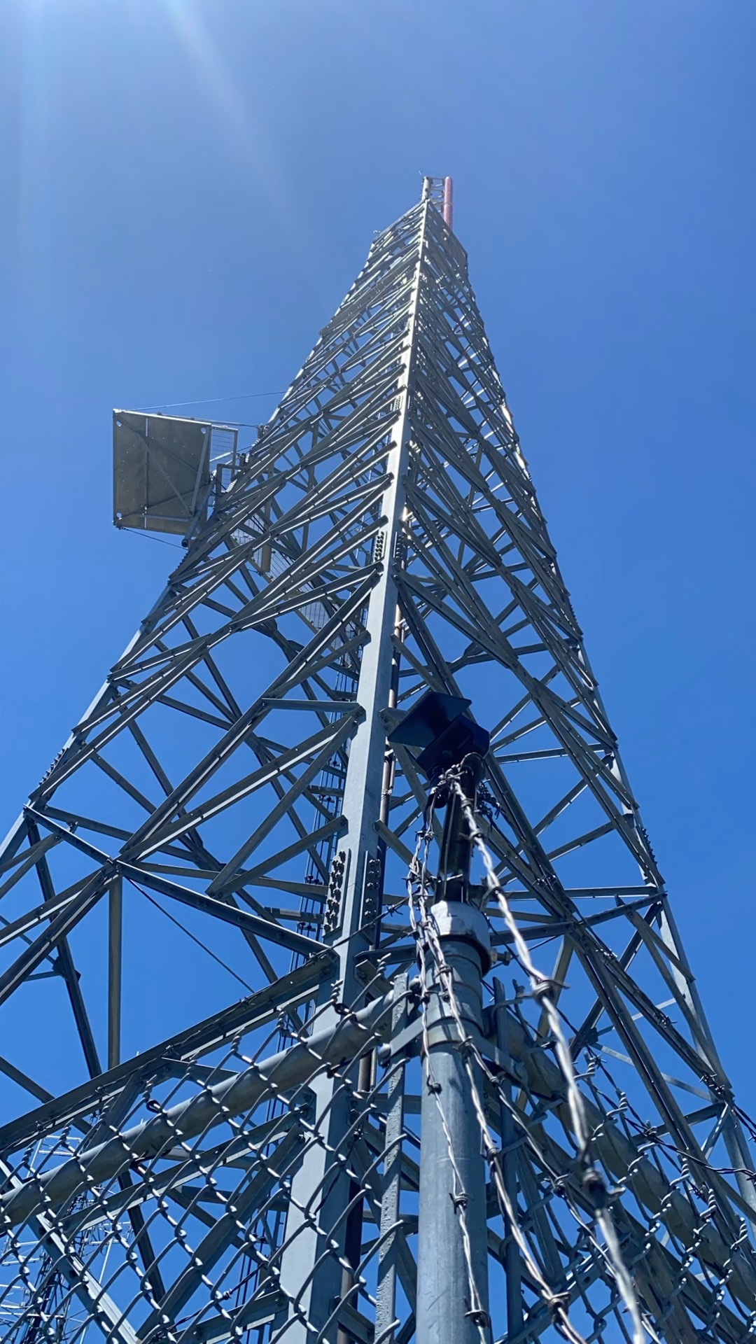
High Sierra maintains relay sites across the region, including McClellan Peak, Toulon Peak, Mount Rose, Bald Mountain, Eagle Ridge, and West Red Peak. Dave has granted MeshEnvy permission to install on all of them. That is a significant commitment from an operator who already shares his compounds with ham repeaters, ARES groups, and public safety systems up and down the state. More sites are slated thanks to his incredible support.
Walking the fence at Peavine
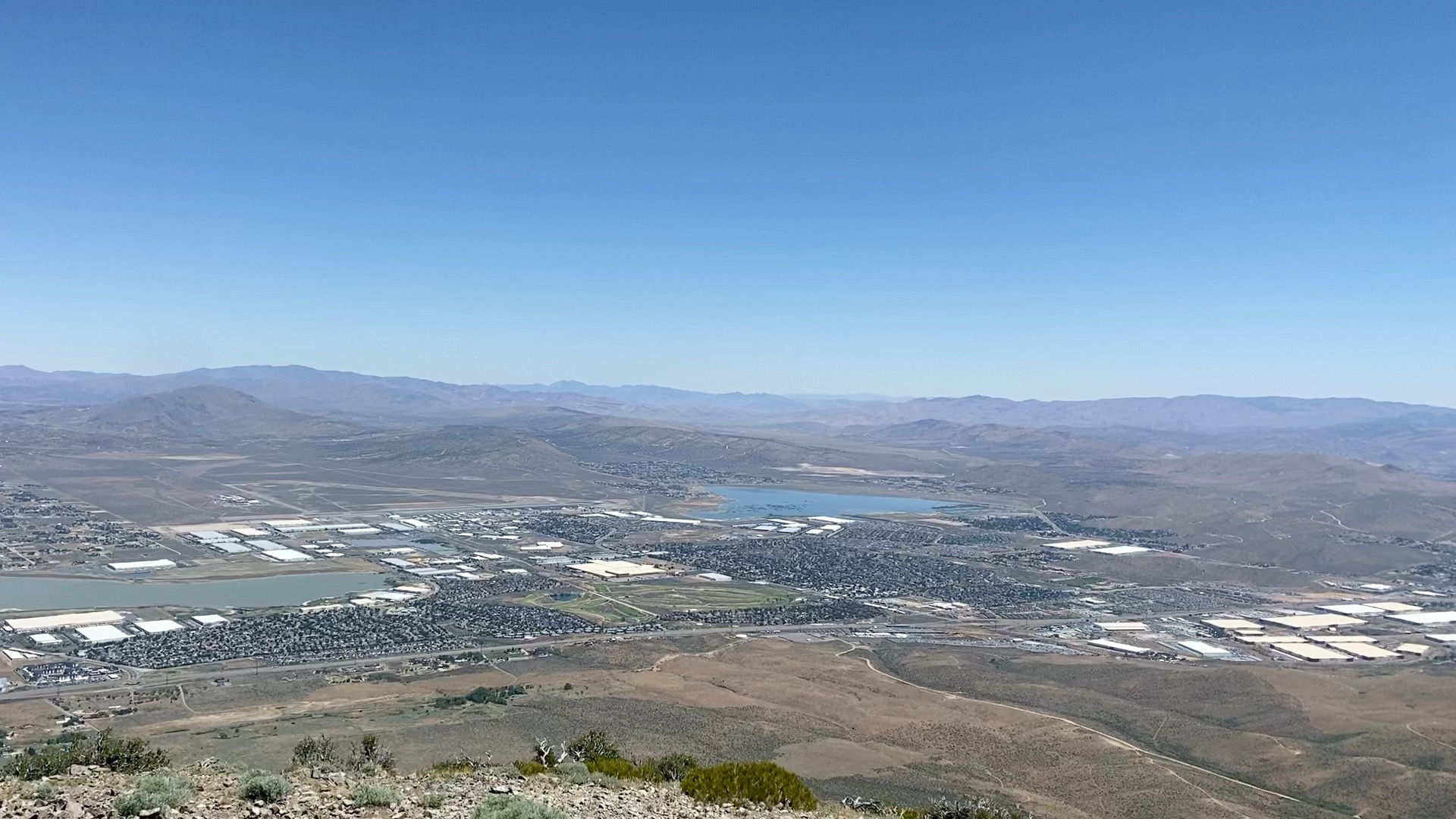
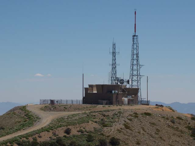
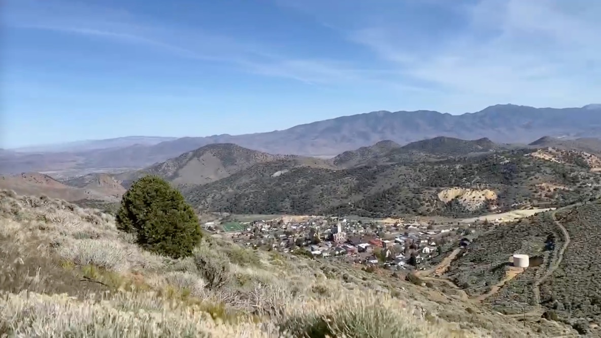
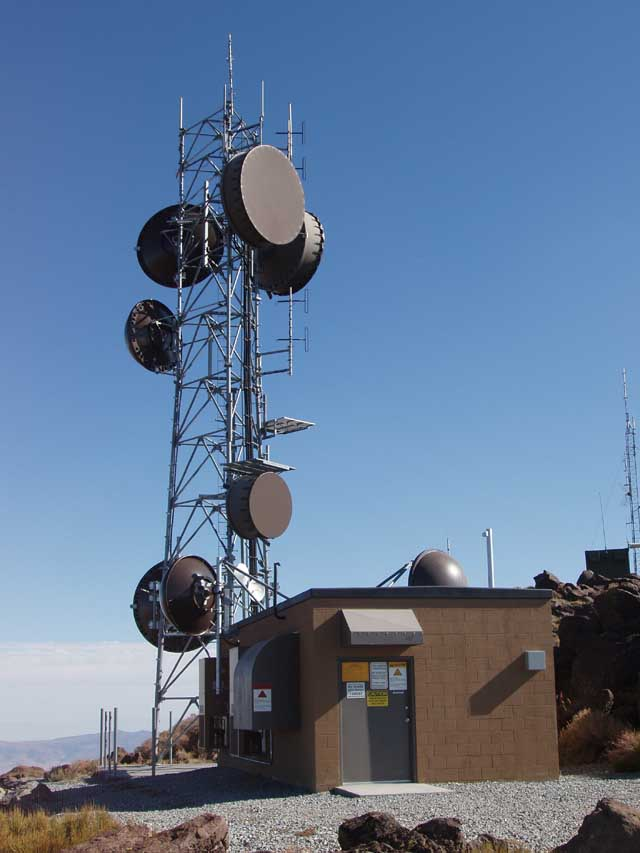
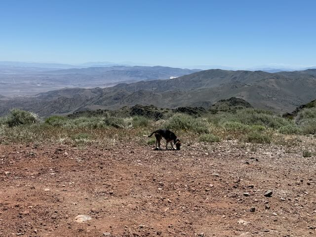
Peavine Peak dominates the skyline northwest of Reno and Sparks. A lot of communication sites share that crest, but Dave's is widely considered the crown jewel of Peavine because it sits at the highest point with the most line of sight.
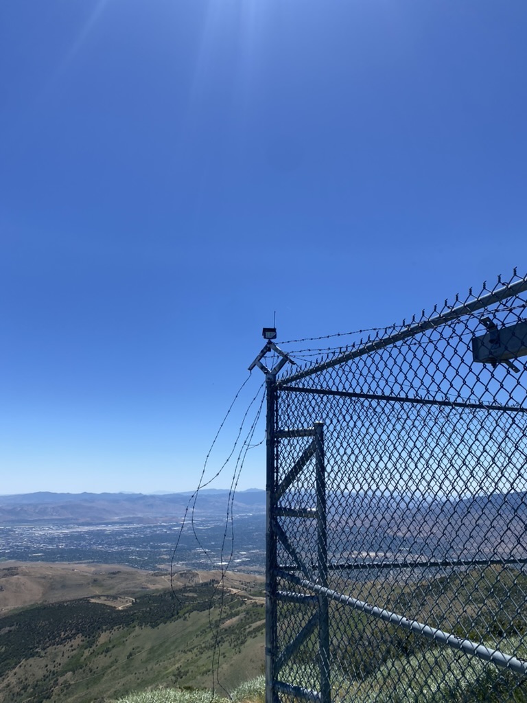
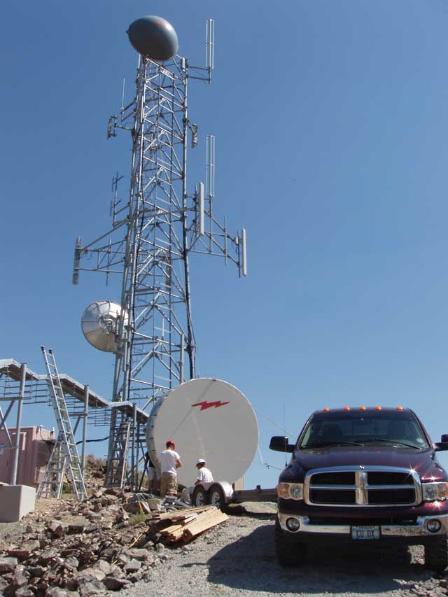
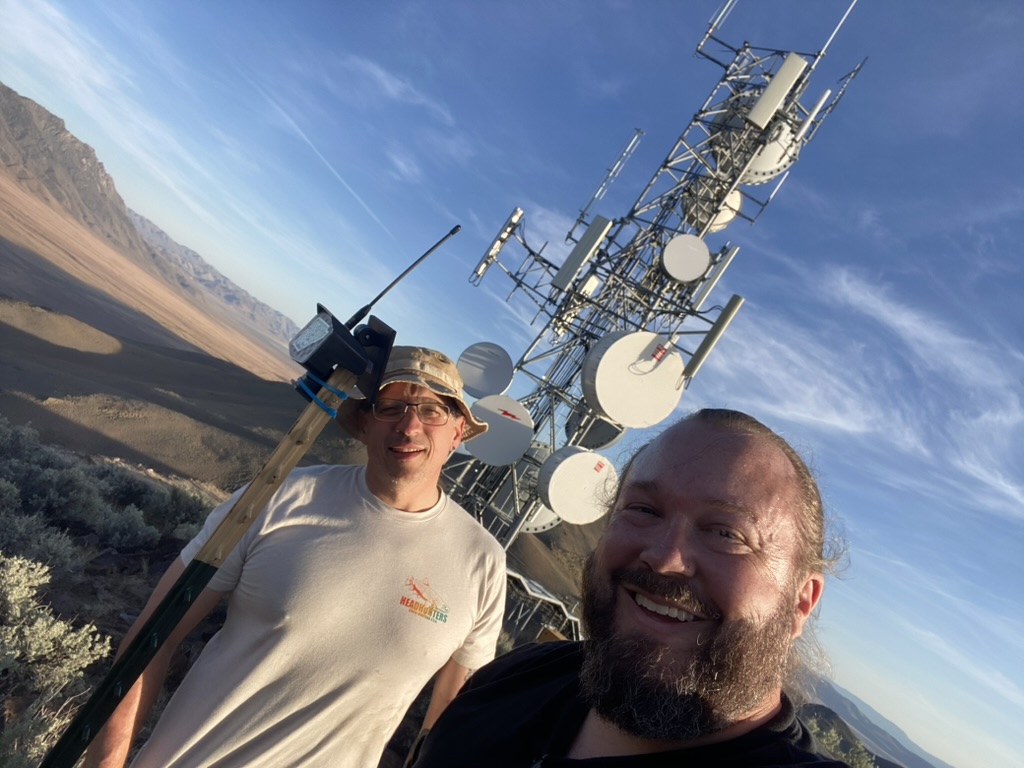
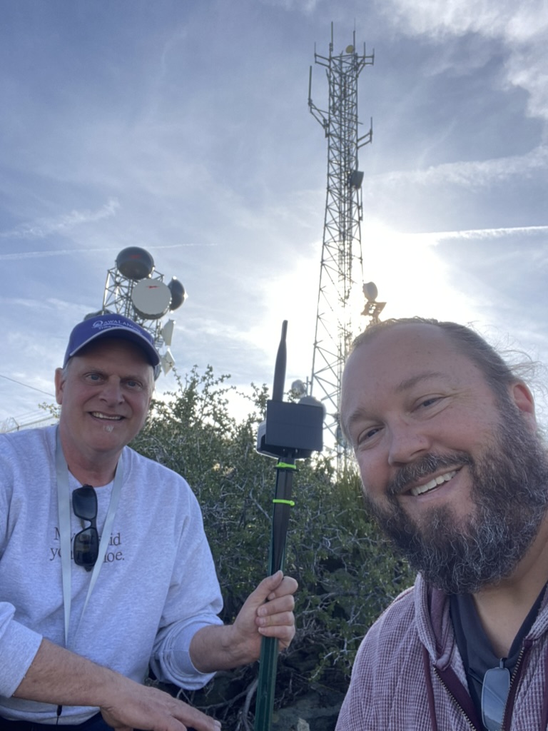
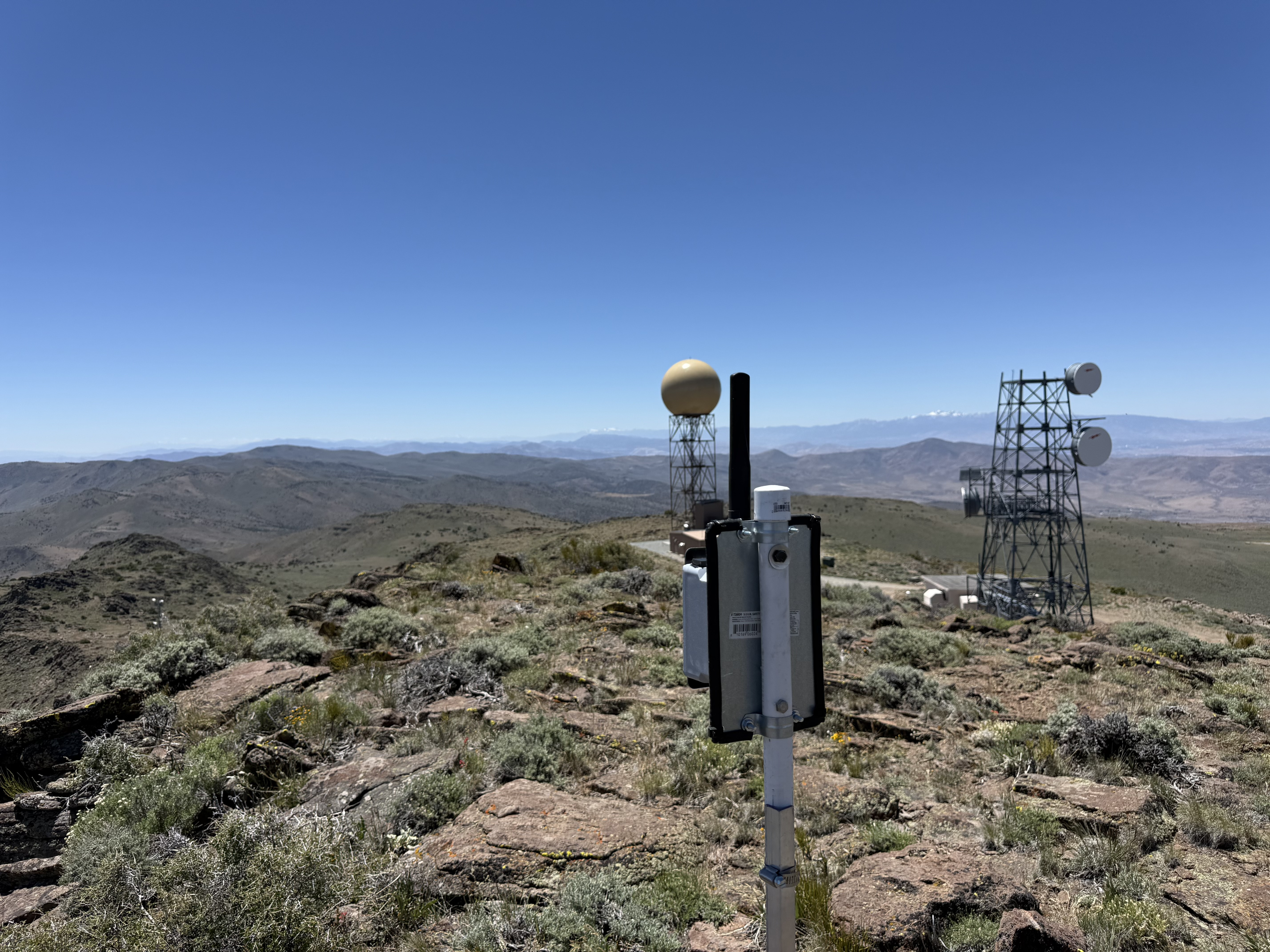
I walked the perimeter of his site, guarded by about five rows of barbed wire along the chain-link fence surrounding the premises. Once I found a good spot for an initial node placement, I called Dave to confirm I had permission. He said yes without hesitation. The node overlooks all of Reno, Sparks, and Cold Springs. It is an absolutely fantastic location. I cannot thank Dave enough for his generosity, or for treating community backbone the same way he treats the repeaters and emergency systems already on his towers: as something worth making room for.
As with many of our placements, the initial jank node is a way to go from zero to one without a lot of expense. We put a node on a fence post or a nearby structure so that we do not have to engage skilled tower climbers or get blocked by complexity. We gradually improve on things and see how the node behaves in the environment as field data begins to come in.
That interim step is deliberate, not a shortcut. Getting something on the air tells us more than another afternoon of spreadsheet modeling. When the site performs the way we expect, we work with Dave's team on a more permanent mount.
Peavine Peak
Peavine forms one of the most recognizable landmarks in the Truckee Meadows. The west summit rises to about 8,266 feet and already carries a dense cluster of towers and dishes visible from almost anywhere in Reno.
The mountain has a long human history. Prospectors worked placer deposits here as early as the 1850s. John Poe established the Paymaster Mine and the town of Poeville on the northeast flank in the 1860s and 1870s. In 1942, the U.S. Grazing Service and the Mono National Forest cooperated to build a fire lookout on the summit, complete with two-way radio back to Reno. That lookout could see from Alpine County to Pyramid Lake. Today the crest is defined by microwave relays and trunking sites rather than fire spotters, but the logic is the same. Height and visibility are everything.
We also have a separate partnership with Sierra Electronics on the same ridgeline. Peavine is that kind of peak. Multiple operators, multiple paths, and room for a small mesh node to add community backbone capacity without getting in anyone's way.
Poito Mountain
Poito Mountain sits near Empire on Nevada State Route 447, south of Gerlach and the Black Rock Desert corridor. The summit elevation is about 5,759 feet, modest compared to Peavine or Virginia Peak, but strategically placed for coverage along the highway that links the playa country to the rest of the state.
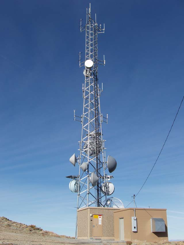
Poito Mountain anchors public safety and interoperability radio for the NV-447 corridor. Washoe County tactical crossband repeaters and the Nevada Shared Radio System depend on height here to reach the remote stretches between Nixon, Empire, and Gerlach. High Sierra operates microwave paths through Poito Mountain as part of the relay network Dave has maintained for more than four decades.
For MeshEnvy, Poito Mountain extends the backbone toward the Black Rock country and the communities that live along that lonely highway. It is a different kind of summit than Peavine: lower, drier, and focused on keeping a long road connected.
Ophir Hill
Ophir Hill rises to about 7,782 feet in the Virginia Range above historic Virginia City in Storey County. The name comes straight from the Comstock. The Ophir Silver Mining Company opened the first major claim on the Comstock Lode in 1859, and the hill above Virginia City has carried that name ever since.
From the crest you look down on the Comstock towns, across Washoe Valley, and out toward Reno and the Sierra. The summit already hosts substantial communications infrastructure, including Dave's High Sierra relay site. We wrote about our first zero-to-one test on Ophir Hill earlier this spring. That jank node on a T-stake talked with both Spanish Benchmark and Peavine across roughly thirty miles of basin and ridge.
Having High Sierra's formal partnership here means we can build on that early proof with Dave's team rather than treating every visit as a one-off field experiment.
Virginia Peak
Virginia Peak is the high point of the Pah Rah Range at about 8,370 feet, the most prominent summit in Washoe County. It sits just south of Pyramid Lake on BLM-managed land and already carries extensive communications infrastructure, including National Weather Service NEXRAD radar.
The Pah Rah Range forms the eastern wall of the Truckee Meadows. From Virginia Peak you can see Pyramid Lake, the desert basins to the north, and the populated valleys to the south. It is exactly the kind of high, clean vantage point where a backbone node earns its keep.
Working with the BLM Carson Field Office already identified Virginia Peak as a priority site on public land. Dave's permission to co-locate at his facility there complements that federal authorization and gives us a trusted operator who already knows the compound.
BLM stewardship on public land
Several of Dave's sites occupy Bureau of Land Management land. Nothing we do on those peaks happens in a vacuum. Private tower infrastructure and public-land authorization have to work together, and the BLM Carson Field Office has been generous with their time and expertise as we survey and test across the district.
We are grateful to the BLM for making co-location possible on the public-land sites where Dave operates. Their stewardship of Nevada's heights is what lets a charity like MeshEnvy put nodes where they can actually matter, alongside the operators who have been maintaining gear on these summits for decades.
Thanks

This partnership would not have happened without Dave Metts and High Sierra Communications. Dave walked me through his vision for the network, opened his sites across Nevada, and let us start small with a fence-post install on Peavine while we learn what the mesh can do from the best seat on the mountain.
What matters most is the spirit behind that access. Dave has built a business on some of the most valuable real estate in Northern Nevada radio, and he consistently dedicates space on those summits to community service: amateur repeaters, emergency nets, public safety backhaul, and now a nonprofit mesh backbone. That kind of sharing is rare. It is also exactly what Nevada needs if we want resilient connectivity that does not depend entirely on commercial carriers.
We are also grateful to the Bureau of Land Management for their role on the public-land sites that make this work possible, and to the amateur radio community leaders who have long recognized what Dave contributes to Northern Nevada.
More field notes from Peavine, Poito Mountain, Ophir Hill, and Virginia Peak will follow as installs go up and range data comes in. For now, we are glad to have Dave and his team on the heights with us.