Virginia Peak: A Backbone Node for Northern Nevada
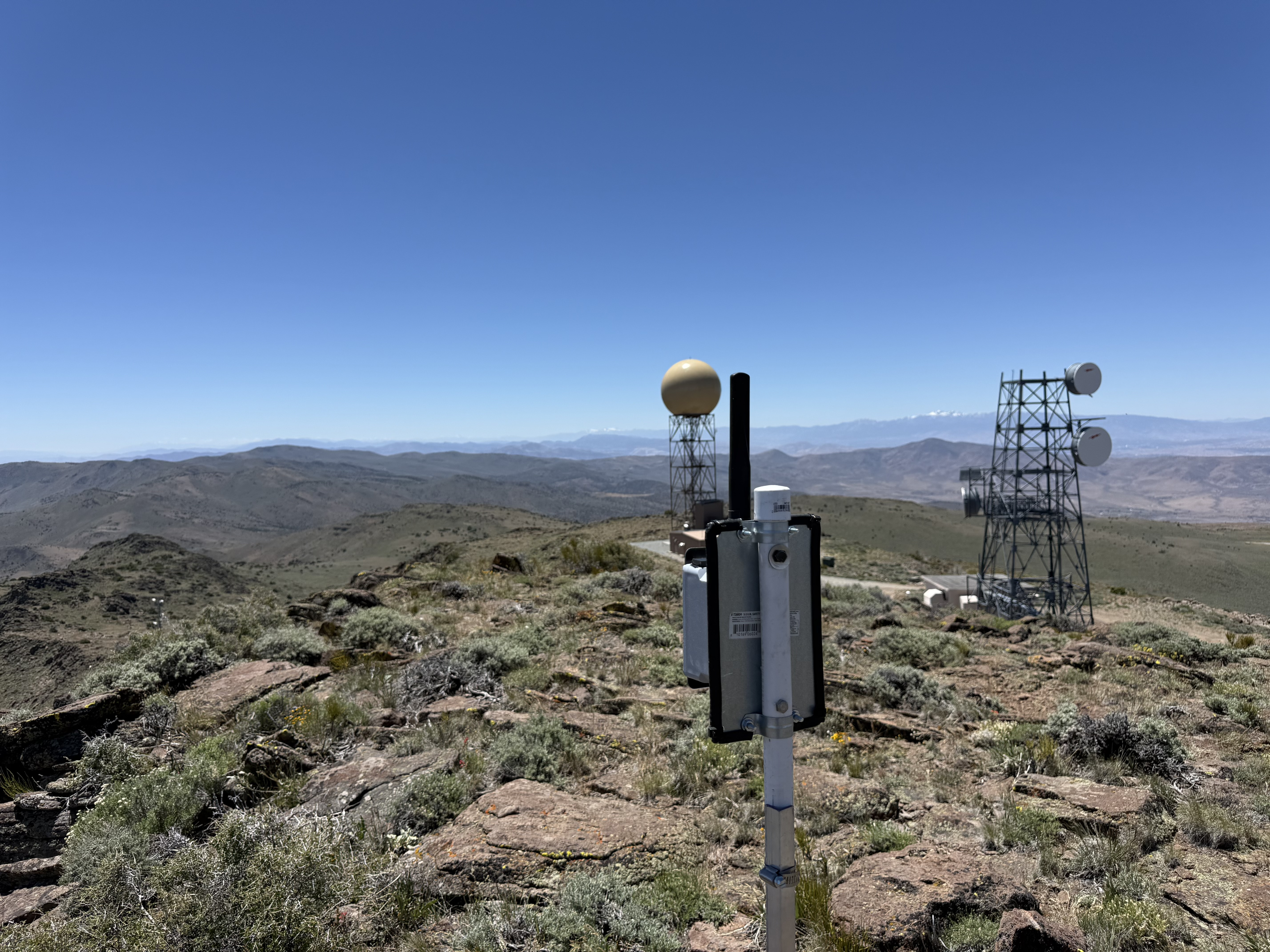
Virginia Peak now carries a MeshEnvy backbone node at the High Sierra Communications facility on the Pah Rah crest. That single placement matters more than most. From one of the highest summits around Reno, we can start tying the Truckee Meadows to the desert basins, playa country, and ridgelines that surround it.
Why this peak earns its keep
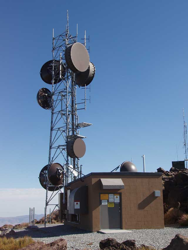
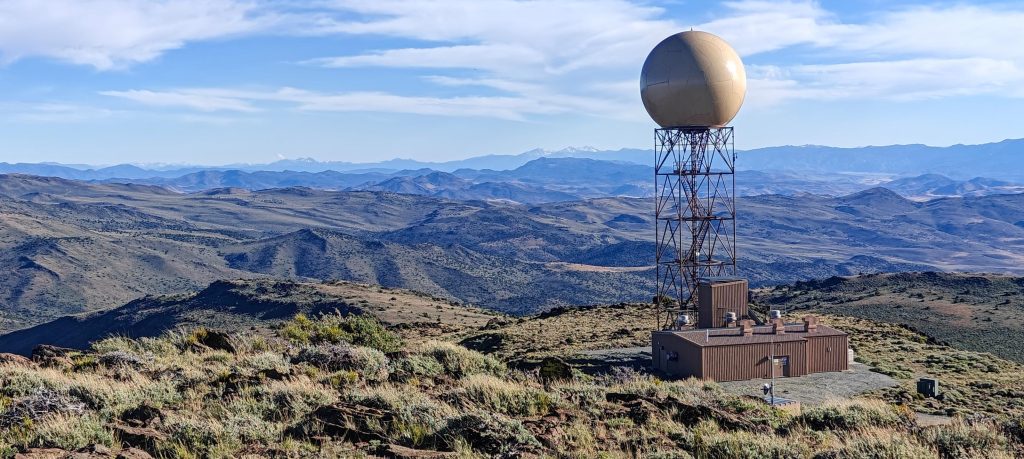
Virginia Peak is the high point of the Pah Rah Range at about 8,370 feet. It is the most prominent summit in Washoe County and sits just south of Pyramid Lake on BLM-managed land. NEXRAD radar, microwave relays, and decades of commercial infrastructure already share the crest. The view from up there is not subtle. You look north across Pyramid and the desert playas, south into the populated valleys, and east across basins that have almost nothing between them and the horizon.
That height is why Virginia Peak connects regions that otherwise feel worlds apart. The Pah Rah Range forms the eastern wall of the Truckee Meadows. A backbone node here can reach toward Peavine, Spanish Benchmark, Ophir Hill, and the other heights we are building across northern Nevada. Under the right antenna setup and atmospheric conditions, paths from Virginia Peak can theoretically stretch all the way to Poito Mountain on the NV-447 corridor south of Gerlach. That is not a guarantee on day one. It is the kind of long-range link this summit makes thinkable.
Our BLM Carson Field Office partnership identified Virginia Peak as a priority site on public land. Dave Metts and High Sierra gave us permission to co-locate at his compound there. Those two pieces of authorization have to work together on a peak like this, and both partners have been generous with their time as we survey, test, and put gear on the air.
Ed, Tater, and zero to one
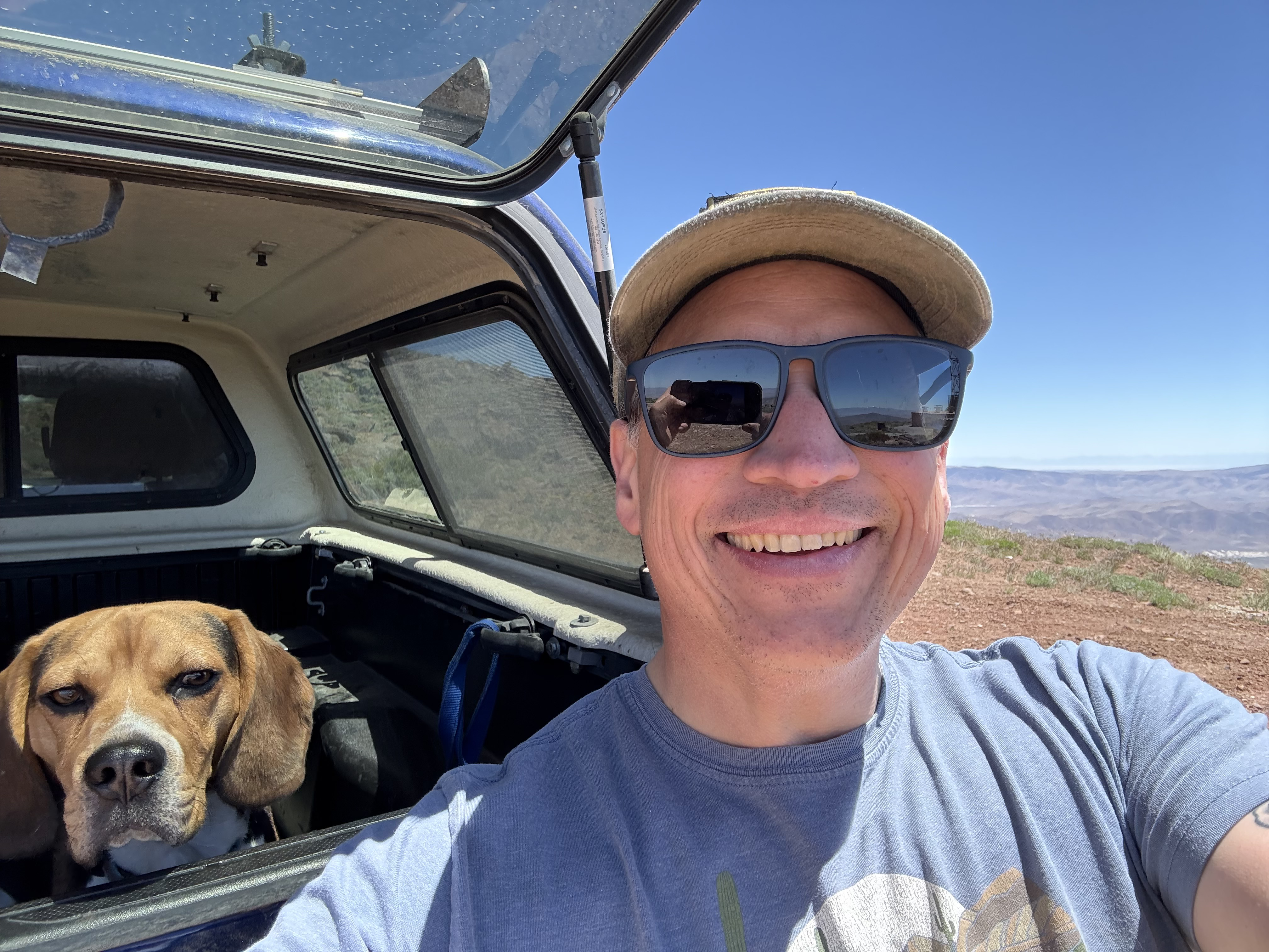
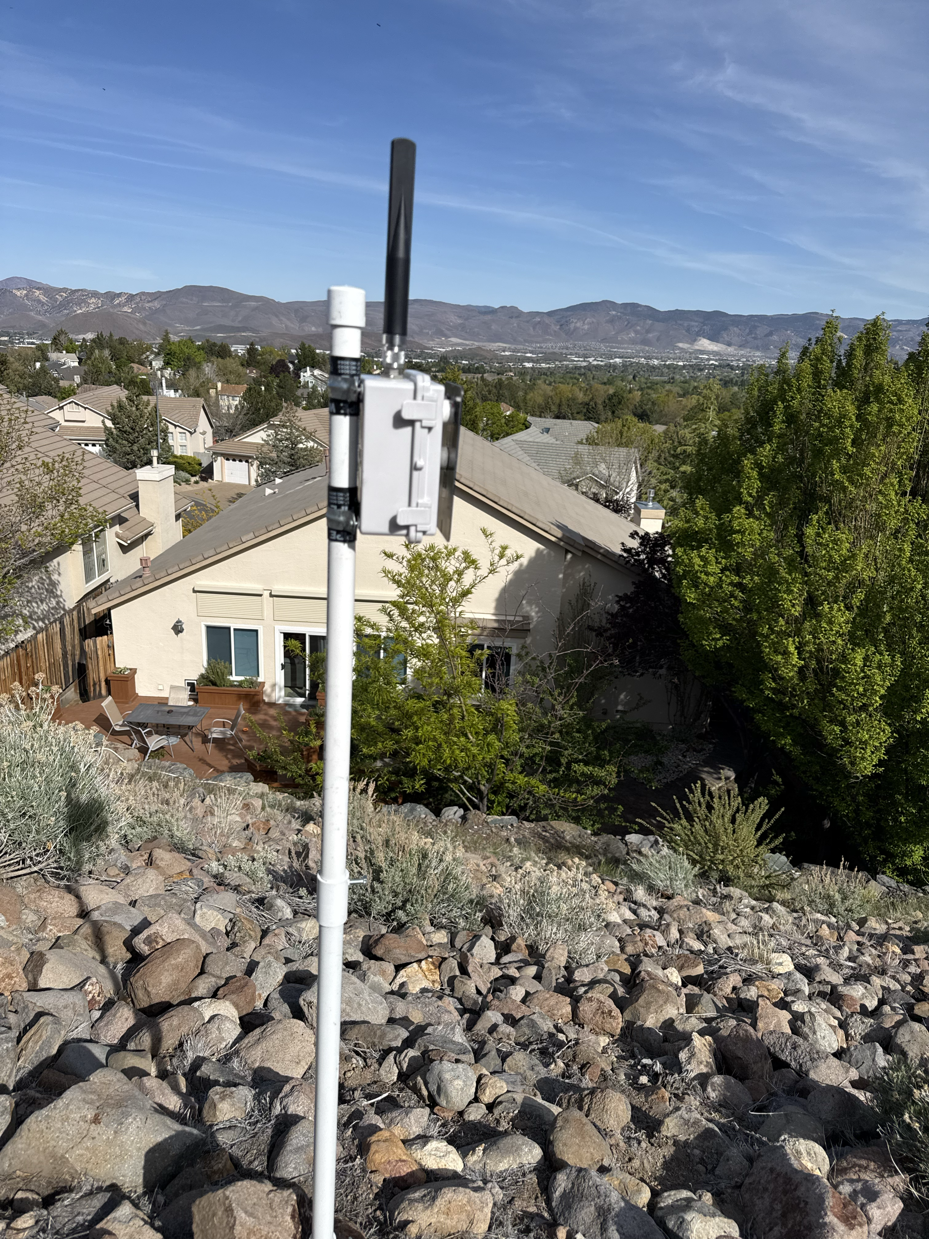
MeshEnvy board director and president Ed Mitchell made a solo trip to the summit with his dog Tater to get our first node planted at the High Sierra site. No fanfare, no convoy of vehicles. Just Ed, Tater, and the work of going from zero to one on a peak that has been on our map since the BLM right of way came through.
They installed a node that will help connect Reno and the surrounding Truckee Meadows communities to the wider Nevada mesh. The mount follows the same philosophy we use everywhere: start with something practical on the ground, learn what the site can do, and improve from there. Virginia Peak is not a fence-post experiment like our first Peavine install, but the goal is the same. Get a live path on the air and let field data tell us what comes next.
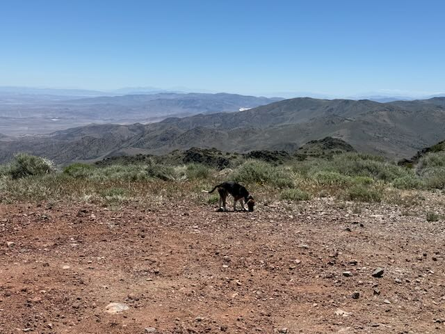
Ed knows these mountains from search and rescue work. Tater has clearly logged enough trail miles to qualify as an honorary field engineer. Together they did the unglamorous part that every backbone build depends on: showing up, placing the node, and making the summit a little more connected than it was when they arrived.
Many designs on the air at once
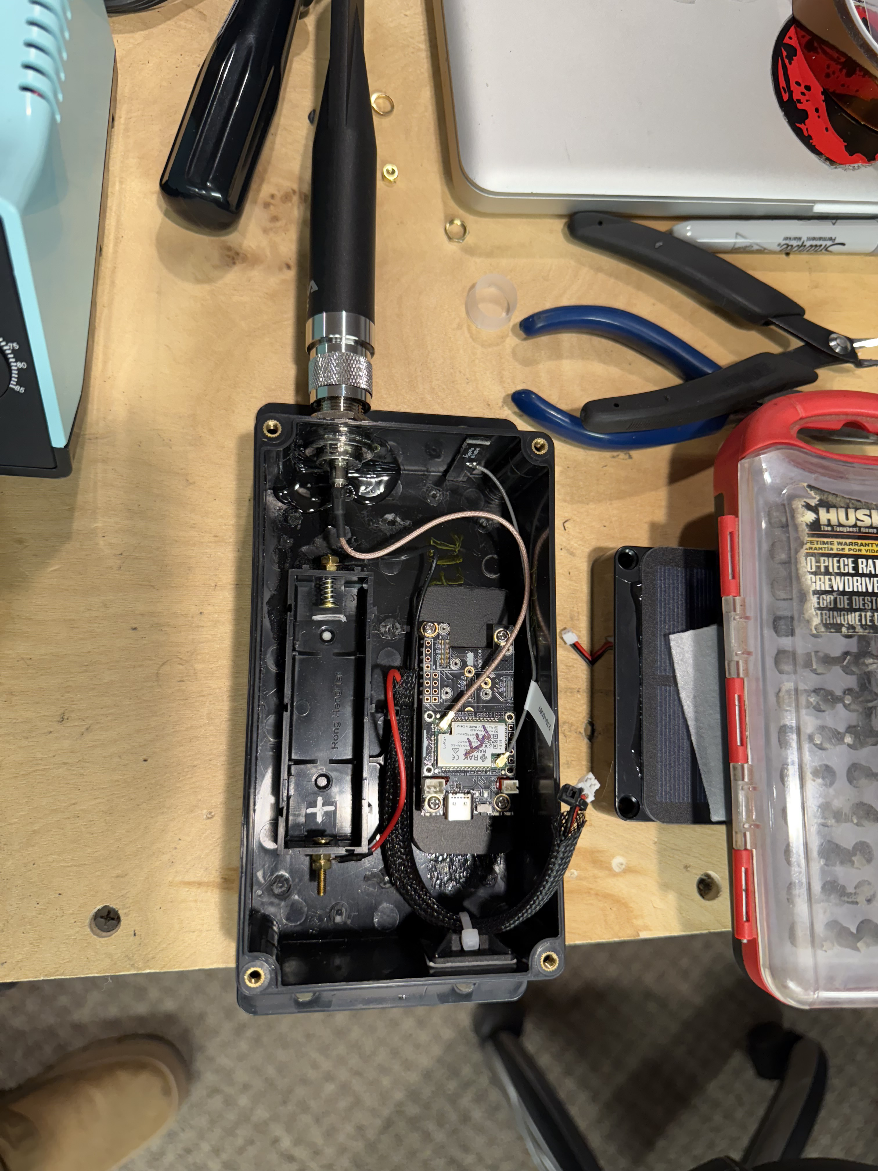
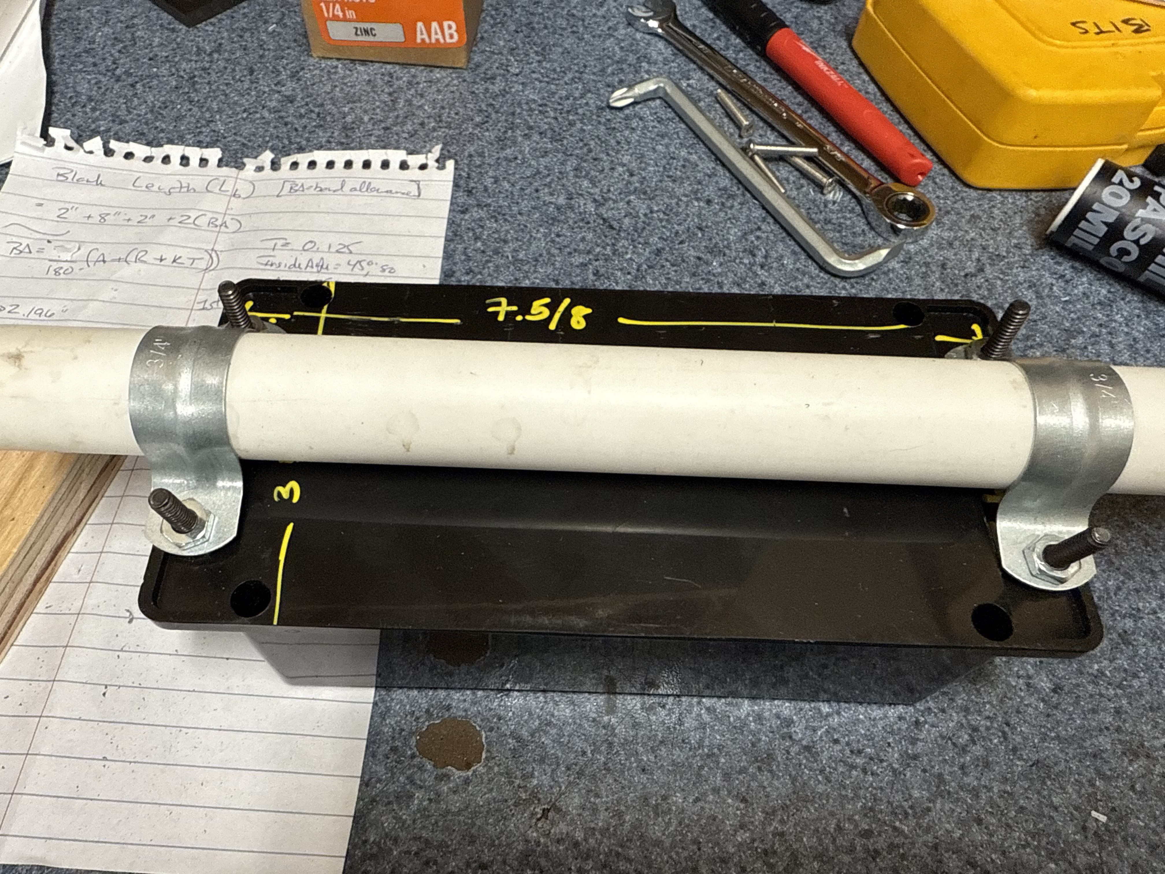
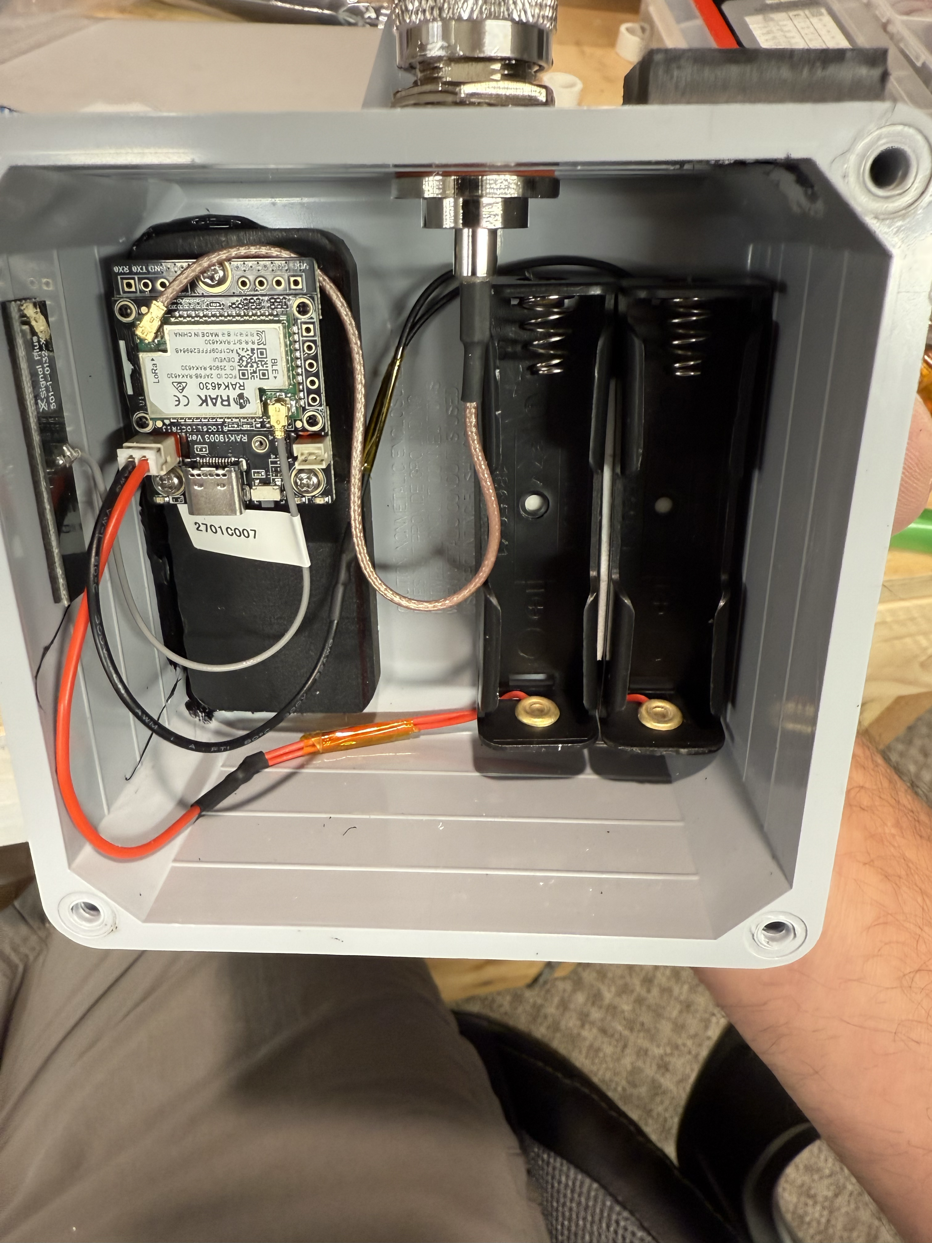
Ed does not wait for a committee to bless a single canonical node before he builds. He works on his own design ideas concurrently, iterating in his shop while the rest of us do the same. When a site like Virginia Peak needs a backbone node, we deploy his builds alongside designs from staff and volunteers, then let field testing tell us which approaches survive Nevada.
That diversity is deliberate. Nevada summits punish gear in specific ways: UV, wind, ice, dust, and temperature swings that would make a coastal engineer wince. No spreadsheet settles which enclosure wins. You put honest prototypes on real peaks and see what still talks after the first bad storm.
Ed's bias runs toward IP67 weatherproof enclosures, sealed bulkhead connectors, and mounts built to stay put for years. My bias runs the other direction: shortest path to deployment, even when the hardware might not last as long. Zip ties and fence posts have their place. So do machined brackets and silicone around every penetration.
Both instincts keep MeshEnvy healthy. We share the workbench and the field results openly. Ideas cross-pollinate. Ed's weatherproofing discipline shows up in my later builds. My appetite for speed shows up in his. Neither of us pretends we have the final answer yet.
Virginia Peak is exactly the kind of site where that experiment pays off. The node Ed and Tater planted is one data point in a living comparison. Range reports, weather events, and maintenance visits will tell us which design choices belong on permanent mounts at 8,000 feet and which were right for getting to zero to one quickly.
Partners on the heights
None of this happens without the people who already maintain gear on Nevada summits.
Dave Metts and High Sierra Communications have been our tower partner from the start of this work on the Pah Rah crest. Dave founded the company in 1982 and built a ridge-to-ridge microwave network across Northern Nevada. He opens his compounds to amateur radio, public safety, and community backbone because he believes height on a Nevada peak should serve more than one paying customer. Virginia Peak is one of several High Sierra sites where MeshEnvy has permission to install. The quality of what we can build from here would not be possible without his cooperation and expertise.
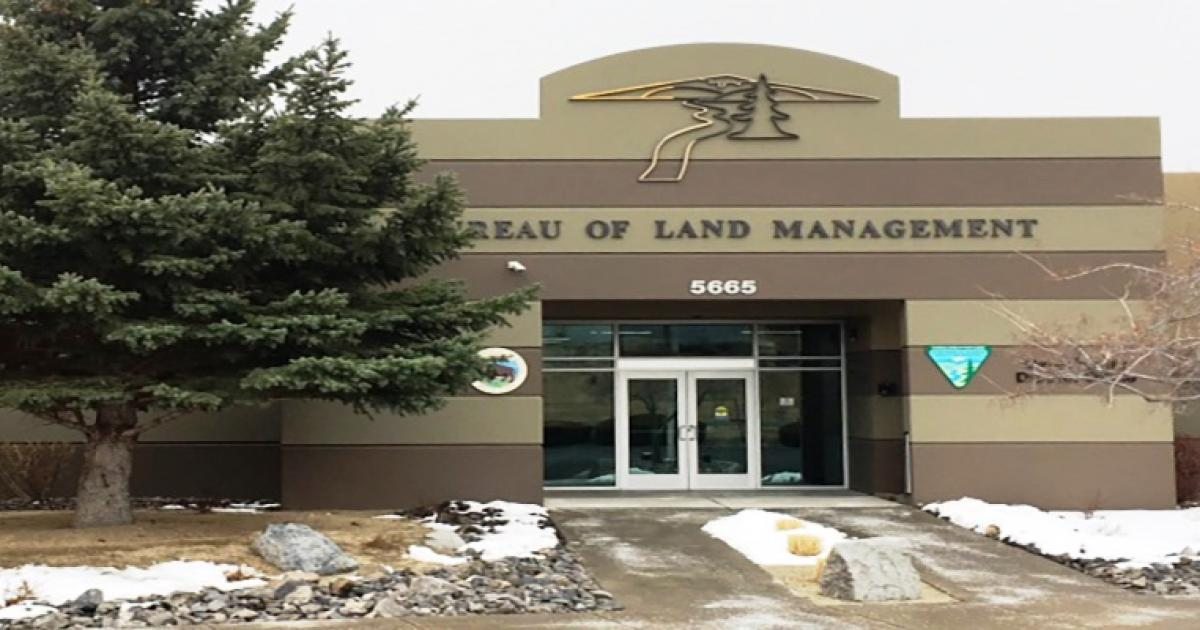
The Bureau of Land Management, and the Carson Field Office in particular, stewards the public land that makes summits like Virginia Peak accessible for authorized field work. Their two-year right of way for site surveys and range testing is what lets a charity like MeshEnvy put nodes where they can actually matter, alongside the operators who have been on these ridgelines for decades. We are grateful for that partnership and for how patiently their team has worked with us as plans turn into boots on the ground.

What comes next
Virginia Peak is a hub, not a finish line. Range testing from the new node will tell us which links are solid today and which need better antennas, better mounts, or better luck with the weather. We will share results as they come in.
For now, we have a backbone presence on one of the best seats in northern Nevada radio, thanks to Dave Metts, High Sierra Communications, the BLM, and Ed and Tater for making the trip. The mesh grows one summit at a time. This one was worth the climb.